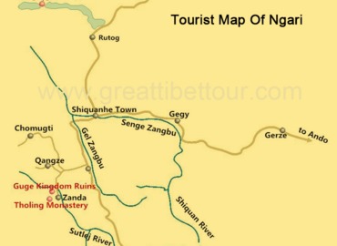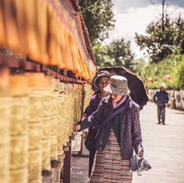
Purang County
- Jennie
- Last Updated : 06/12/2025
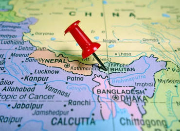
Purang (Burang) belongs to the Ngari Region of Tibet, China. It is located in the southwestern part of Tibet, in the southern part of the Ngari, between the Gangdise Mountains and the Himalayas, and on the border between China, India, and Nepal. Purang County has a special topography, located in the valley of the Mabja Zangbo Peacock River between Abi Gamin ranges and Gurla Mandhata (Mount Namonanyi), and it is the "place surrounded by snowy mountains" in the Ngari region. The original meaning of "Puran" in Tibetan is very peculiar, meaning "one hair." The origin of the name is said to be a reference to the narrow landscape of the Mabja Zangbo River Valley.
Mabja Zangbo River
Mabja Zangbo River(Peacock River) is one of the "four sacred rivers" that originated in Ngari. It is also the important source of the Ganges River, the most sacred river in India. After giving birth to the miraculous Mabja Zangbo River Valley, the river flows into Nepal at Niti Mountain Pass of Puran County. It was renamed River Ghaghara (Karnali) and eventually ran into the Ganges River (Ganga) in India.
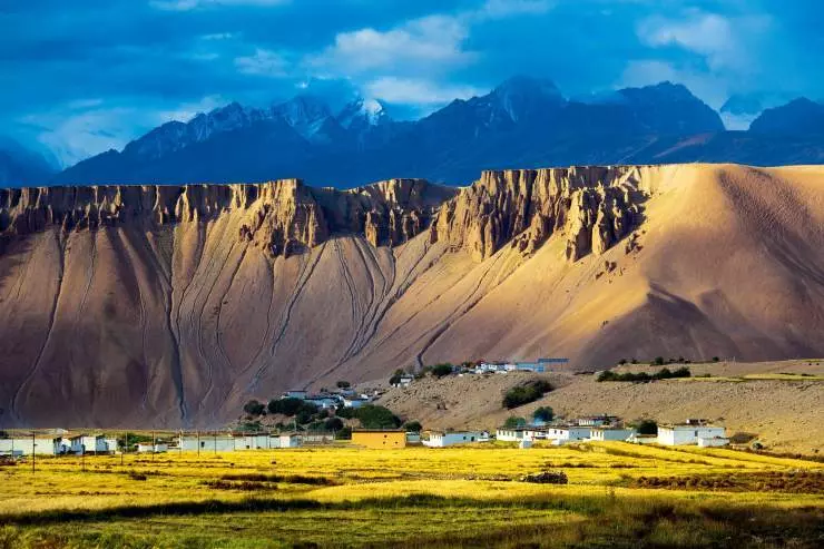
In the Ngari, the Mabja Zangbo River Valley is a rare low-altitude region, only 3,900 meters above sea level. Compared with the average altitude of 4,000 meters in Ngari, the altitude of Puran County is very low. Not only is the altitude here low, but more importantly, the mountain passes cut by the river lead the southern warm and humid airflow from the Bay of Bengal, creating a pleasant plateau microclimate. There are golden rapeseed flowers, green barley fields, lush trees, and clear water streams. On the vast and cold Ngari Plateau, it seems as if a deity has performed miracles here, leaving a wonderland for human beings.
This makes many tourists who experience high altitude sickness in Ngari choose to have a rest in Purang, as it will greatly reduce the symptoms of altitude sickness. If you feel uncomfortable at Mt.Kailash, you can drive to Purang County, about 120 kilometers, 2 hours of driving. On the way, you can pass by the turquoise blue ghost Lake Rakshastal, the holy Lake Manasarovar. Then you can continue south, following the long and narrow river valley cut through the rolling peaks of the Himalayas. The altitude gets lower and lower, when you see the Himalayan mountain range rows of 6 or 7 kilometers of snow-capped mountains unfolding in front of you, then drive ten kilometers further, and you can arrive in Purang County.
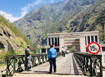
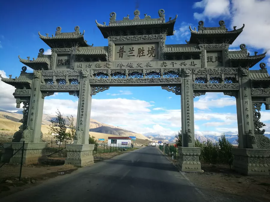
Purang Port
Pulan Port is a traditional border trade port with a long history. The main trading mountain passes are Zherwa Pass, Lipulekh Pass, Tinkar Pass, etc. The import and export of Pulan Port is mainly based on people's mutual trade at the border. The port conducts trade from May to October every year. After the heavy snow in winter closes the mountains, the trade is suspended.
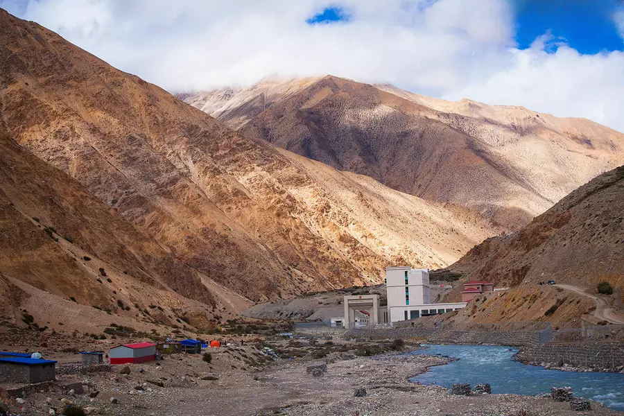
Purang to Nepal and India has more than one channel. It is said that there are more than 20 mountain roads connecting outside. The most popular border crossing is the Zherwa border crossing between China and Nepal. Perched on a hillside on the north bank of the Mabja Zangbo River, Zherwa is a natural village belonging to the village of Kejia. Across the river is Hilsa Village (Nepali: हिल्सा, hilsā) in Nepal, which is located at the foot of the mountains. There is a bridge connecting the two sides, and the straight-line distance is only a few hundred meters. There is an airport in Simikot, where the county seat is located, from where helicopters can transport pilgrims heading to the Holy Mountain and Lake to Hilsa Village. So Zherwa border port is mainly used as a port for Nepal and India to enter and exit to pay homage to Kailash. In addition, Hindus and Jains also go north through the Tinkar Pass on their pilgrimage to Mt.Kailash and Lake Manasarovar.
Transportation
A dedicated highway connecting Shigatse and Ngari has been built in Purang County. It can go directly to Lhasa (1,206 kilometers) via Shigatse in the east; or it can reach Urumqi by crossing Shiquanhe Town in the north and turning on the Xinjiang-Tibet Highway, and it is about 20 kilometers away from the China-Nepal border in the south. There is a shuttle bus from Shiquanhe to Puran, which takes 6 to 8 hours. Domestic travelers can also hitchhike or drive themselves. International tourists can only charter tourist-licensed cars.
Tourism
The best season to visit Purang is from June to August when the fields full of grown crops and weathered yellow sand land and silver snow peaks contrast with each other. It shows the harmony and unity of man and nature.
Purang Tourist Route
Mt.Kailash→Mt.Namonanyi→Lake Manasarovar→Lake Rakshastal→Kejia Monastery→Xianbolin Monastery→Purang County
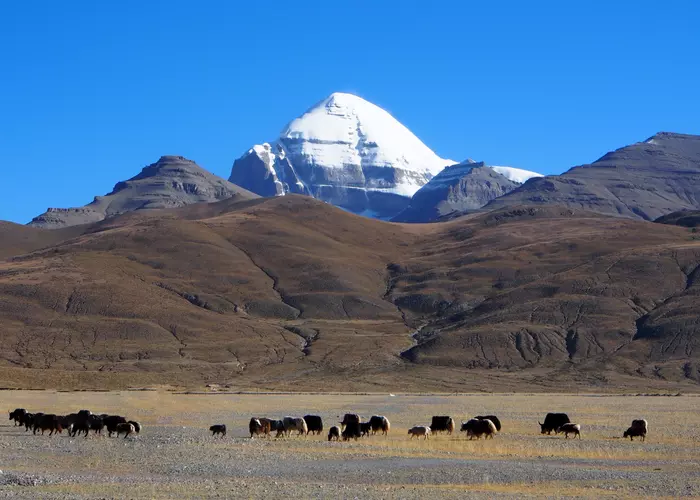
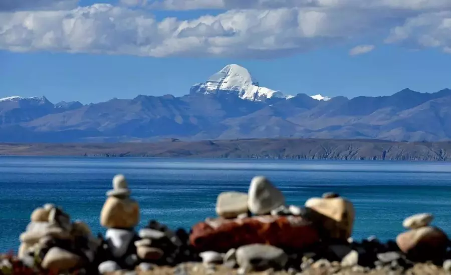
Mt. Kailash
Mt.Kailash (6,656m), in the Tibetan language, means "the treasure of the snowy mountains". The peak has a unique shape. Its dome-shaped peak is covered with snow all year round. No matter which direction you look at it, it looks like a huge ice and snow pyramid standing on the top of the mountains. For those who believe in Hinduism, Buddhism, ancient Jainism, and Bon religion, it is supreme and the center of the entire world. Being able to go to Puran and pay homage to Kailash is the greatest blessing in life.
Lake Manasarovar
Manasarovar Lake is located 20 kilometers southeast of Mount Kailash and on the north side of Namunani Snow Peak. It has an altitude of 4588 meters and reaches a maximum depth of 70 meters, making it the highest freshwater lake in the world. Chiu Monastery, located on the west bank of the holy lake, is the best place to view Manasarovar.
Lake Rakshastal
Known as the ghost lake, Lake Rakshastal(4,574m) is not far from Lake Manasarovar. In fact, holy Lake Manasarovar and ghost Lake Rakshastal were originally one lake. Due to climate change, the lake retreats, and the water surface declines, with only a narrow hill separating it into two. But the strange thing is, after being separated, Lake Rakshastal gradually became a saltwater lake, but Lake Manasarovar, not far away from Rakshastal, is a freshwater lake.
Mt.Namonanyi
Mt.Namonanyi (7,694m) is located in the western section of the Himalayas, locally known as the "Mother of God" or "Goddess Mountain". There is the largest glacier group in the Himalayas. Looking at Mt.Namonanyi from the foot of Mt. Kailash, you can see majestic snowy peaks reaching into the sky in the clouds and mist, making it dazzling.
Kejia Village
Kejia Village has a history of more than 1,000 years, with Kejia Monastery as the center, which is surrounded and connected by village houses, where the ancient Kejia Tibetan Opera has been passed down until now, and it is a thousand-year-old village on the banks of the Mabja Zangbo River.
Kejia Temple
Kejia Temple was built in the early 12th century. The temple enshrines a statue of Manjusri Bodhisattva blessed by the eminent monk Rinchen Sangpo. Legend has it that the statue passed by here on its way to Gar, and the Buddha suddenly said to stay here. So a large sutra hall was built here to worship the Buddha statue. The temple later became an important temple on the border between China, India and Nepal, and was jointly believed by believers in the three countries.
Xianbolin Temple
Xianbolin Temple was the first major temple in Ngari. It was built in the early 17th century during the reign of the fifth Dalai Lama, Lobsang Gyatso, and is under the jurisdiction of the Drepung Monastery of the Gelug Sect in Lhasa. Standing on top of the mountain, you can see the surrounding snow-capped mountains, and the Mabja Zangbo River valley with the green scene.
Email response within 0.5~24 hours.