Gyantse Map
- by Eric
- Last Updated: 2024-06-24
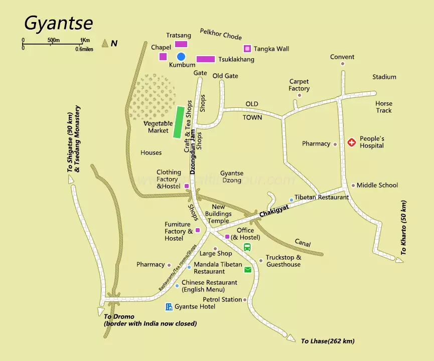
Located in the southern part of the Tibet Autonomous Region, on the north bank of the upper reaches of the Nianchu River, a tributary of the Yarlung Zangbo River, Gyantse means "the summit of victory, the residence of the King" in Tibetan. Because the Nianchu River flows through here, people also called Gyantse area "Nian" in history. Gyantse is located in the westernmost part of Tibet, 254 kilometers away from Lhasa. In the town, there are stone roads covered by loess. However, The most famous feature of Gyantse is its glory as a "hero city", where there was an epic history of resisting foreign aggression. On the top of the mountain in the center of Gyantse County, there stands a castle. This is the famous anti-British site of Gyantse Dzong at home and abroad.

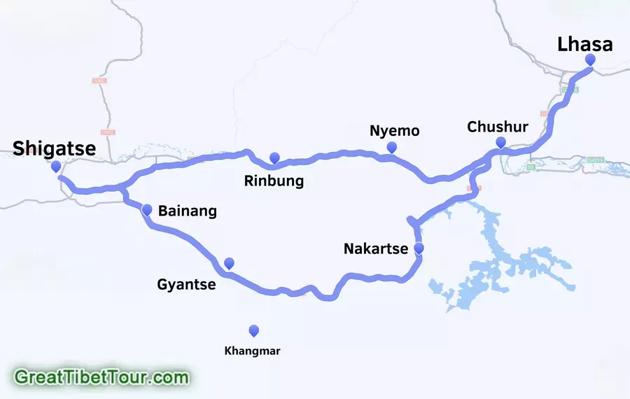
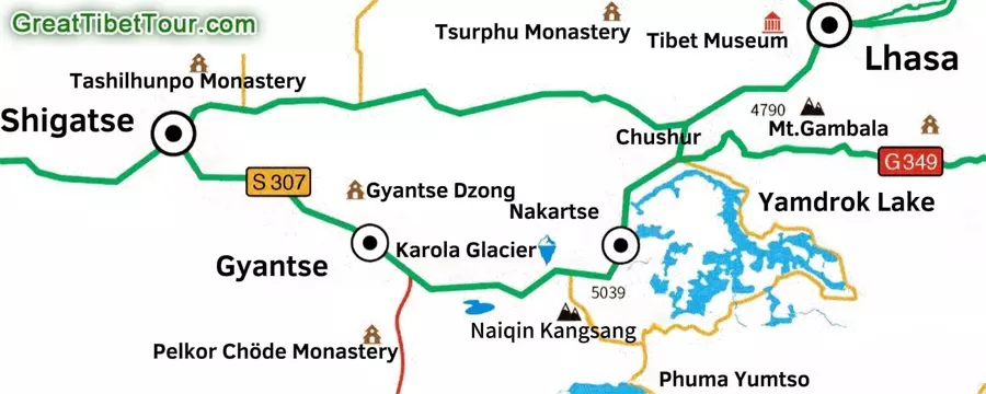
Gyantse County belongs to Shigatse City. It is geographically located in the east of Shigatse, bordering Nakartse County to the east, Kangma County to the south, Bainang County to the west, and Rinbung County to the north.

On the way from Lhasa to Shigatse, if tourists take the southern route, they will see Yamdrok Lake- Karola Glacier - Manla Reservoir - Gyantse Dzongshan - Tashilhunpo Monastery. Usually when returning to Lhasa, tourists will take the northern route and follow the Brahmaputra River Valley back to Lhasa.

Related Articles
- Tibet Map
- Gyantse Travel Guide
- Maps of Kathmandu
- Ngari Map
- Lhoka Map
- Where is Tibet?
- Lhasa Map
- Shigatse Map
- Nyingchi Map
- Gyantse Attractions
Email response within 0.5~24 hours.


