Lhasa Map
- by Beatrice
- Last Updated: 2024-07-02
Lhasa, the capital and political, economic, and cultural center of the Tibet Autonomous Region. It is located in the middle of the Qinghai-Tibet Plateau and southeast of the Tibet Autonomous Region. With an altitude of 3650 meters above sea level, Lhasa is one of the highest cities in the world and also known as the "Sunlight City". Lhasa is the first impression of a Tibet tour for most travelers.
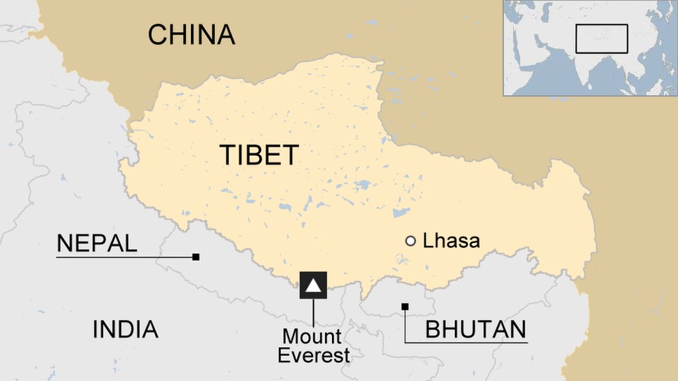
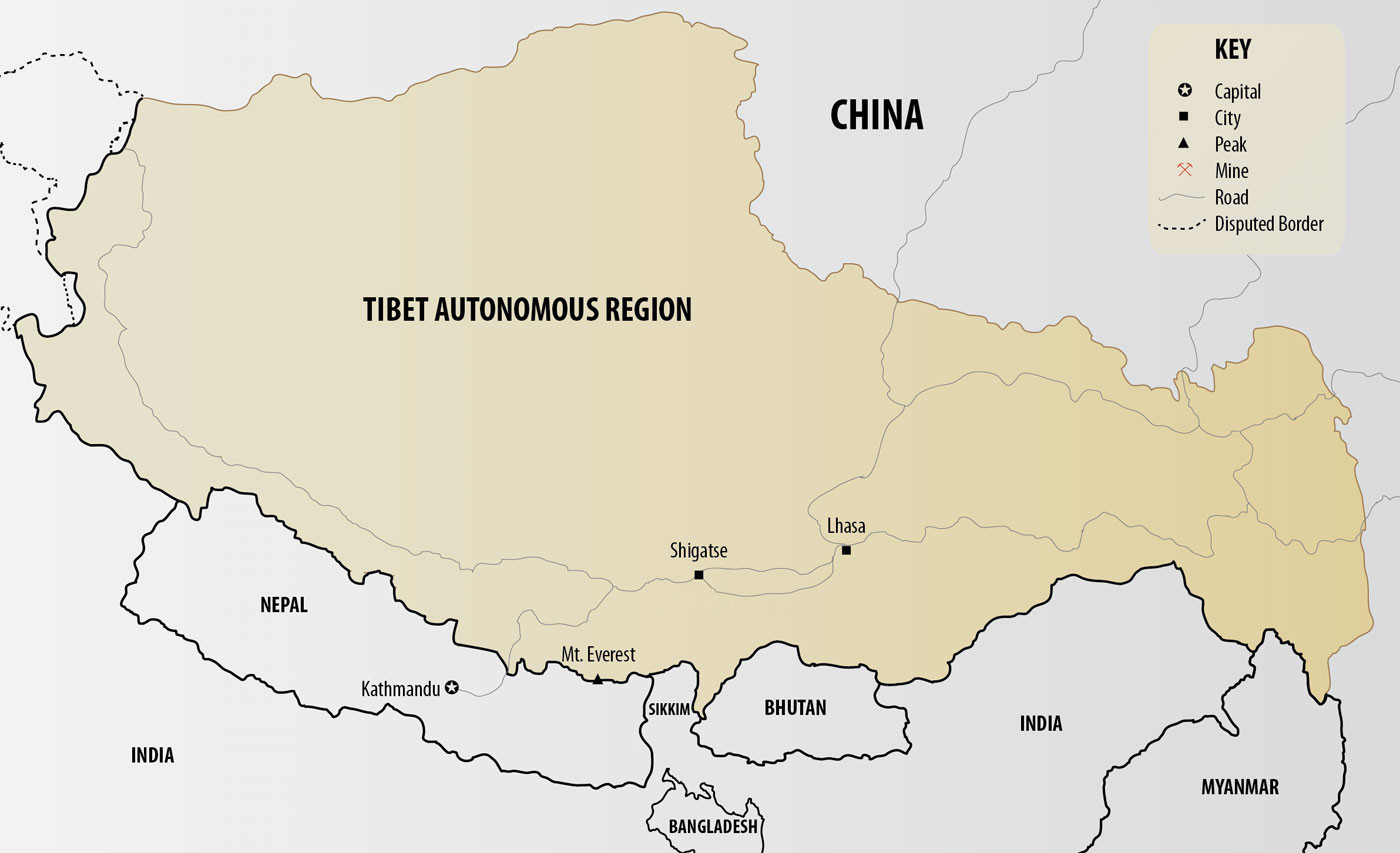
Where is Lhasa on a Map
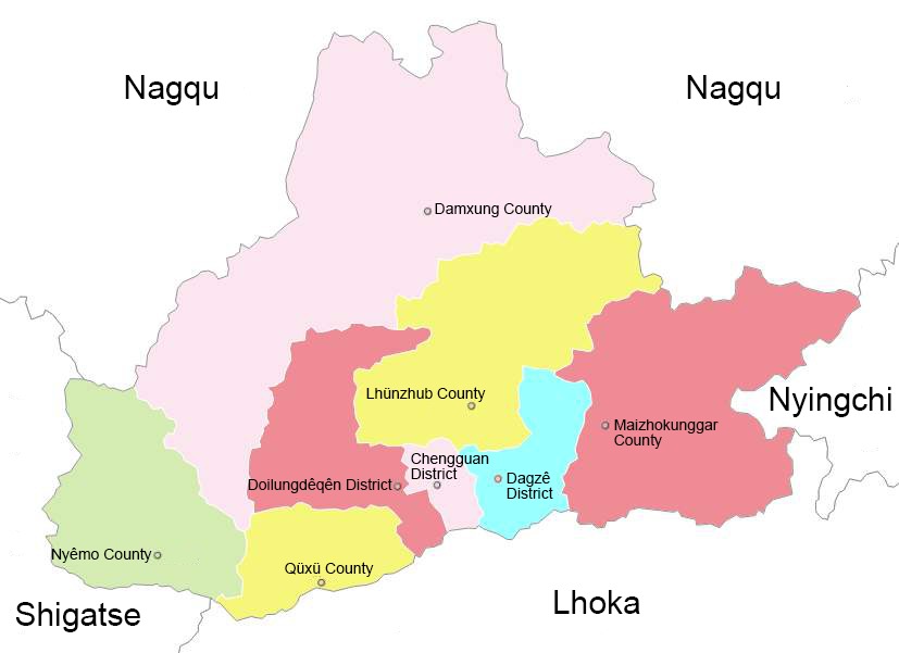
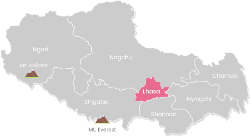
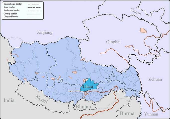
Lhasa stands on the north bank of the Lhasa River which is a tributary of the Yarlung Zangbo River. The city spans 277 kilometers from east to west and 202 kilometers from north to south, with a total area of 29,518 square kilometers. Tibet is composed of one city and six prefectures. Lhasa is encompassed by Nagqu in the north, Lhoka in the south, Shigatse in the west, and Nyingchi in the east. Beyond that, there are Ngari and Chamdo which are not connected to Lhasa.
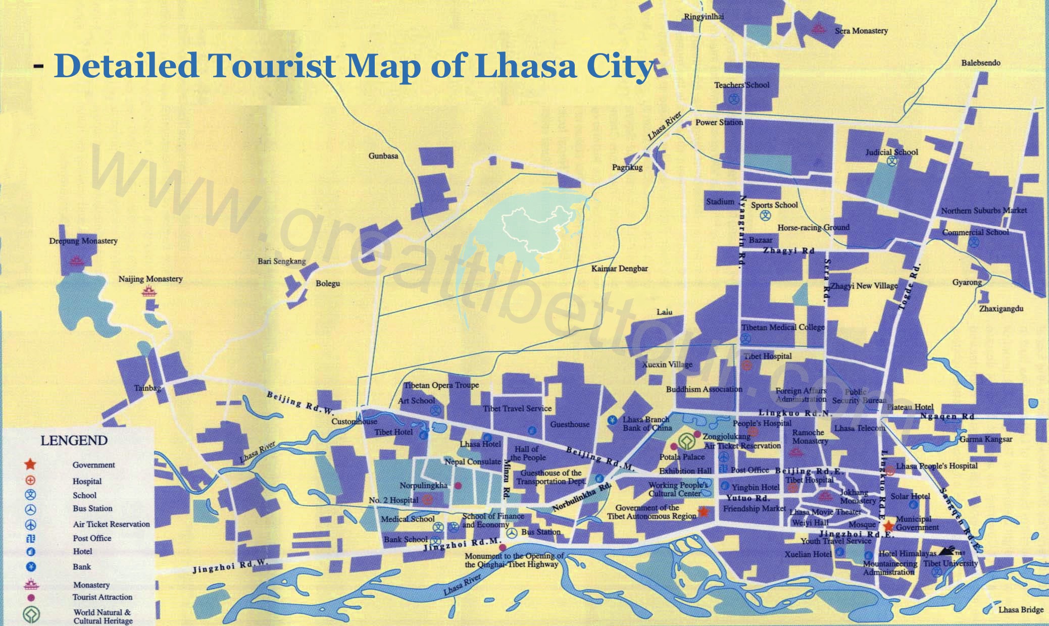
Lhasa Tourist Map
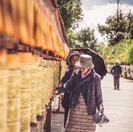
The 1300 years of history leaves Lhasa countless cultural relics and a strong religious atmosphere. There are many famous attractions worth visiting.
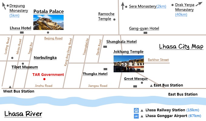
The Potala Palace, located on the Mabuli Mountain in the northwest of Lhasa city, is the highest building in the world, integrating palaces, castles and monasteries. The Jokhang Temple built by the great King Songtsan Gampo is the earliest civil structure in Tibet. Barkhor Street is located in the old city of Lhasa. It is a famous circuit road and commercial center in Lhasa. The Ramoche Temple to the north mainly enshrines the 8-year-old statue of Sakyamuni. Drepung Monastery, Ganden Monastery and Sera Monastery are collectively known as the three major monasteries in Lhasa and are representative buildings of the Gelug Sect of Tibetan Buddhism. And beautiful Namtso lake, “precious garden” Norbulingka, relaxing Yampachen Hot Springs, etc. make Lhasa one of the most distinctive and charming cities in the world.
Lhasa Transportation Map
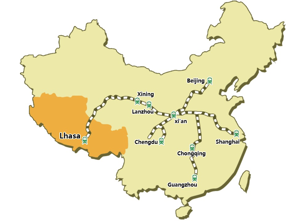
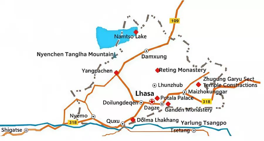
Currently, there are 7 railway routes to Lhasa, which respectively depart from Beijing, Shanghai, Guangzhou, Chengdu, Chongqing, Lanzhou, and Xining. Although it takes a long time to go to Lhasa by train, the scenery along the way is beautiful, and you can also see grasslands, Gobi, and deserts. When the train passes through Hoh Xil, you may see Tibetan antelopes.
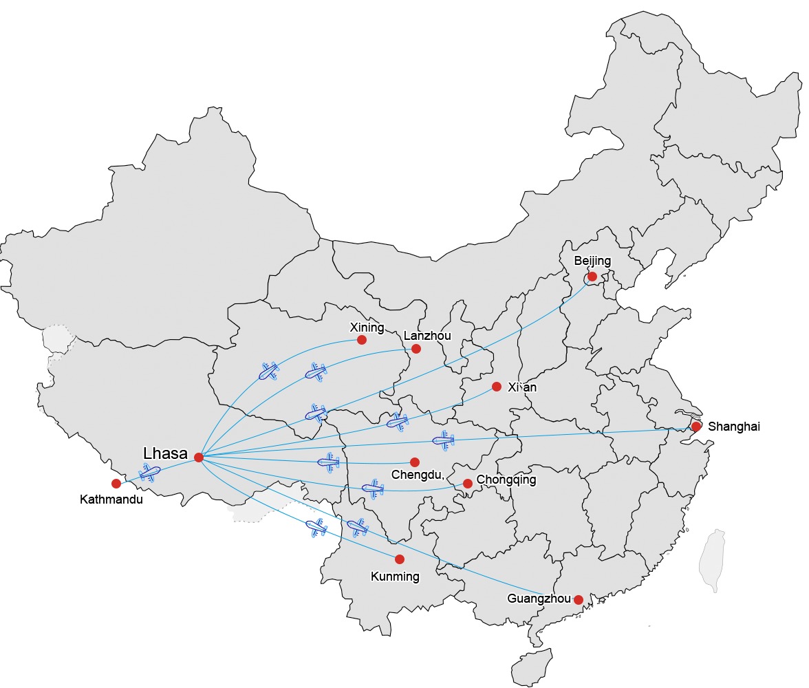
Flying to Lhasa is the most time-saving way. From China, it's very convenient to take domestic flights to Lhasa from many cities, such as Beijing, Shanghai, and Guangzhou. Passengers can see stunning snow-capped mountains on the plane. The only international flight to Lhasa is from Kathmandu. From there, you can choose the seat on the left side of the plane to enjoy the mighty Himalayas.
Lhasa Terrain Map
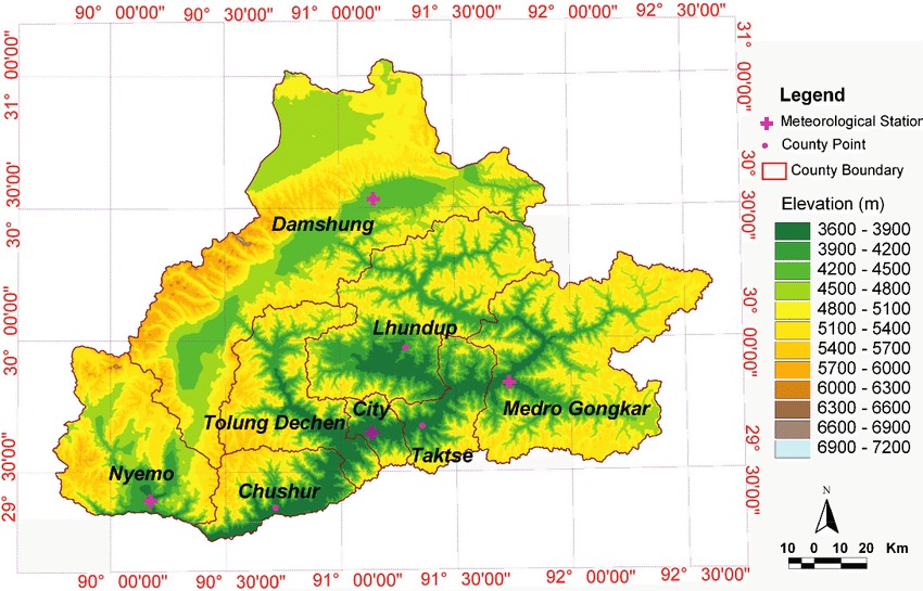
The terrain is high in the north and low in the south, sloping from east to west. The central and southern part is the plain of the middle reaches of the Lhasa River, a tributary of the Yarlung Zangbo River. The highest point, the summit of the Nyainqentangla Snow Mountain is 7,117 meters above sea level.
Lhasa Administrative Map
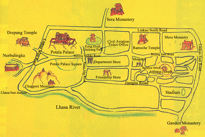
There are 2 municipal districts and 6 counties in Lhasa, namely Chengguan District, Duilung Deqen District, Damxung County, Nyemo County, Quxu County, Lhinzhub County, Dagze County, and Mozhugongka County.
Related Articles
- Tibet Map
- Maps of Kathmandu
- Ngari Map
- Lhoka Map
- Road to Tibet
- Where is Tibet?
- Shigatse Map
- Gyantse Map
- Nepal Bhutan Tibet Travel Map
- Nyingchi Map
Email response within 0.5~24 hours.



Typically Asked Questions from Our Clients
Asked by Sami***
We, two friends would like to travel Lhasa from Kolkata. Give me proper information about visa, permission etc.
Thanking you
We can arrange your Lhasa tour if Tibet opens to international tourists. Besides Lhasa, is there anywhere else you are going? For visiting Lhasa, your China visa and Tibet Travel Permit are required. However, if you are going from Kathmandu, a China group visa instead of a China visa if required. It looks complicated but we can help you apply for your visa and permit.