Yarlung Tsangpo River
- Merry
- Last Updated : 09/19/2024
Yarlung Tsangpo, the highest river in the world, originates from the Jiema Yangzong Glacier (over 5,000m) at the northern foot of the Himalayas in southwestern Tibet(Ngari Prefecture). The upper reaches are called the Maquan River. From west to east, it stretches across southern Tibet. It passes through Shigatse, Lhasa, Shannan, and Nyingchi in Tibet. After receiving major tributaries such as the Laka Zangbu River, Nianchu River, Lhasa River, and Niyang River, it goes around Namcha Barwa Peak, the easternmost peak of the Himalayas, and turns to the south flow, exiting China via Pasighat. After It flows into Sadiya in India, it is called Brahmaputra. After flowing into Bangladesh, it is renamed Jamuna. The river joins the Ganges near the city of Goelundo in Bangladesh, finally flowing into the Bay of Bengal in the Indian Ocean. It is 2,840 km long. The riverbed is mostly above 3,000 meters above sea level, making it the highest celestial river in the world.
Origin of the Name
Yarlung Zangbo River(also known as Yarlung Tsangpo) originates in the Tibet Autonomous Region of China. In Tibetan ཡར་ཀླུངས་གཙང་པོ་, "Yarlung" and "Yalong" have the same meaning, referring to coming from the sky. Yalong itself is also a place name, that is, today's Shannan area in Tibet. "Zangbo" means river. The river was eventually named "Yarlung Zangbo River", which is inseparable from the final unification of the Qinghai-Tibet Plateau by the Xibuye tribe in Yalong area(the ancestors of Songtsen Gampo). This river flows through the main birthplaces of Tibetan civilization. It is regarded as the "cradle" and "mother river" by the Tibetans.
Geographical location
To the south of the Yarlung Tsangpo stands the world's highest & youngest Himalayas, and to the north are Gangdise Mountains and Nyenchen Tanglha Mountains. Between the north and south is the Southern Tibet Valley, called "Luoka" in Tibetan, meaning "south". The valley is a wide and low area running from east to west where Yarlung Tsangpo lies quietly in this valley. Consistent with the topography of the valley, the Yarlung Tsangpo basin is long & narrow from east to west, and short & narrow from north to south. The maximum length from east to west is about 1,500 kilometers, while the maximum width from north to south is only 290 kilometers.
Cradle of Tibetan Civilization
The ancient culture nurtured by Yarlung Tsangpo has a long history. The Neolithic culture in its basin is represented by Nyingchi and Motuo. Relics such as stone tools, pottery fragments, axes, adzes, and chisels have been collected in Nyingchi County and Motuo County.
In the late Neolithic Age, many tribes formed throughout Tibet. Around the 3rd century BC, Nyatri Tsampo, as the leader of the Yalong tribe of the Yarlung Tsangpo, first appeared in Tibetan history as a Tsampo (meaning king) and established the Tubo Kingdom of tribal slavery.
Yarlung Tsangpo River is not only the cradle of the birth and development of Tibetan civilization but also a witness to the cultural exchanges between the Han and Tibetan peoples. In the history of Sino-Tibetan exchanges, the most memorable events are the marriage of Princess Wencheng to Songtsen Gampo, and Princess Jincheng's marriage to Tibetan King Me Agtsom, as well as Tang-Tibetan alliance stele. They fully illustrate the close relationship between the Han and Tibetan people and their cultures, which have their own characteristics but influence & integrate with each other.
Tibetans worship Buddhism universally and sincerely. Following the belief in Buddhism, there are monasteries and temples along the Yarlung Tsangpo streams, no matter beside the canyons or in deep mountains. Among these monasteries and temples, the Potala Palace and Tashilhunpo Monastery are the most representative.
Source of the Yarlung Tsangpo
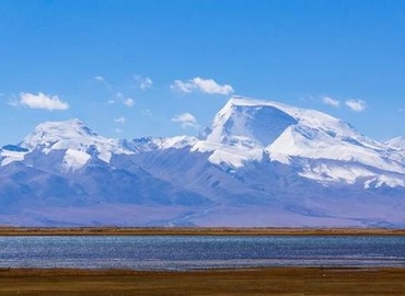
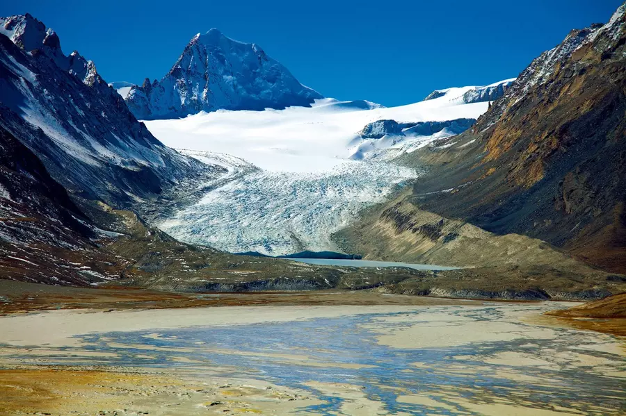
The source is 5,590 meters above sea level. The river source area consists of two rivers, Jiema Yangzongqu and Kubi Zangbo. At the source of the two rivers are Jiemayangzong Glacier, Xiabuga Glacier, Angruo Glacier, Asejiaguo Glacier, etc., which form a huge solid water reservoir. As the glaciers retreated into large areas of moraines, the valley was shaped as "U". According to measurements, whether it is the basin area, river length or flow, Jiemayangzongqu should be the main source.
Upstream
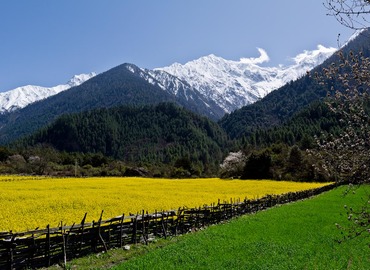
The upper reaches are from the main source, Jiemayangzongqu, to Lizi, with a total length of 268 kilometers, a catchment area of 26,570 square kilometers, and a water level drop of 1,190 meters. The river valley is 1 to 10 kilometers wide but the river channel with water flowing all year round is only 30 to 40 meters wide, less than 1 meter deep, with clear water. After joining the southern source Kubi Zangbo at Sangmu Zhang, it is called Maquan and flows eastward to Lizi in Saga County. The entire upper reaches of the waterway are winding and scattered, dotted with lakes and ponds, and the water is very shallow and crystal clear. The grass on both sides of the river valley is lush, and it is particularly beautiful during the flower blooming season. It is sparsely populated, but it is a paradise for wild animals. Some rare animals such as wild yaks, Tibetan antelopes, blue sheep, Tibetan wild donkeys, Tibetan jackals, plateau foxes, snow leopards, pikas, rabbits and marmots live leisurely and peacefully in the valley.
Midstream
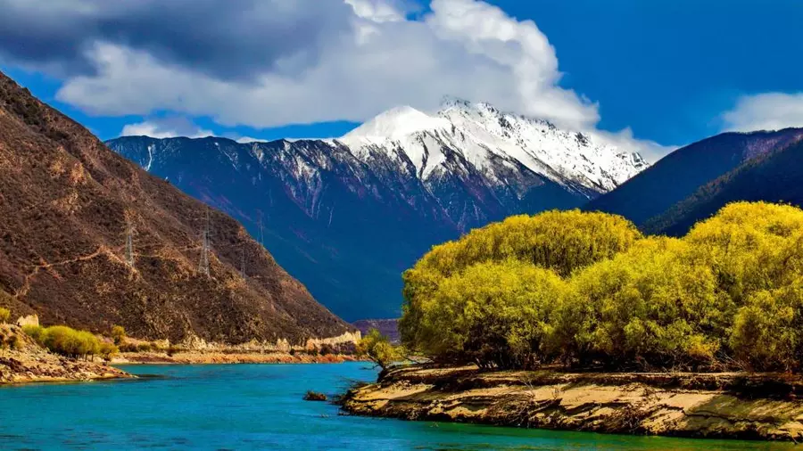
Below Lizi, the middle reaches of the Yarlung Tsangpo River pass through Lhatse, Shigatse, Qushui, and Tsedang to Pai Township in Milin County, with a total length of 1,340 kilometers and a water level drop of 1,520 meters. There are many tributaries, with a catchment area of 163,951 square kilometers. The middle reaches of the river have alternating widths and narrow valleys. In the wide valley section, the valley bottom is 2 to 8 kilometers wide. The water flow is gentle and the average slope of the river is less than 1‰. In the canyon section, the river valley is "V" shaped, with steep mountains on both sides, a valley bottom width of 50 to 100 meters and a turbulent water flow. The middle reaches of the river gather the main tributaries of the Yarlung Tsangpo, with abundant water, wide and deep, providing favorable conditions for plateau shipping. Leather boats and wooden boats can go from Lhatse in the west to Tsedang in the east. It is about 400 kilometers long, the highest navigable river section in the world. The river valley plains such as Lhasa, and Shigatse, which are formed by alluvial deposits from tributaries, are all below 4,100 meters above sea level. They are the most important and prosperous agricultural areas in Tibet, known as the "granary" of Tibet.
Downstream
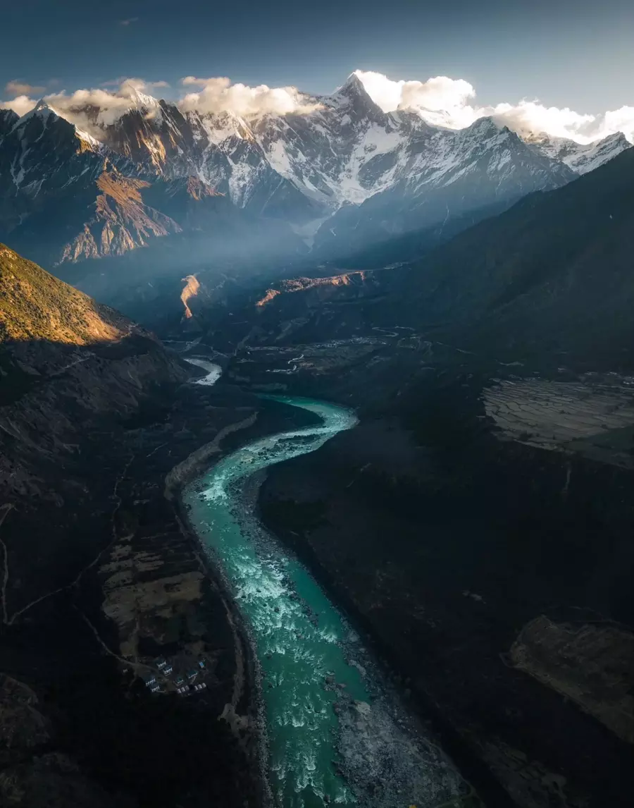
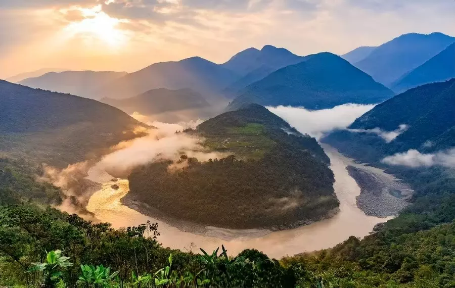
The lower reaches of Yarlung Tsangpo are from Pai Township in Milin County to the vicinity of Pasighat. The river is 496 kilometers long, having a water level drop of 2,725 meters. The catchment area is 49,959 square kilometers. The surging river gradually turns northeast from near Lilong in Milin County, and then turns to the northeast after passing Pai Township. Finally, it enters a continuous mountain canyon section and flows into India through Pasighat. On both sides of the top of Big Bend, there are the Gyala Peri Peak and the Namcha Barwa Peak with an altitude of 7,151 meters and 7,756 meters respectively. The vertical height difference from Namcha Barwa to the surface of the Yarlung Tsangpo is 7,100 meters, which is regarded as the deepest canyon in the world - the famous Yarlung Tsangpo Grand Canyon. The river here is narrow, dotted with reefs at the riverbed, with strong currents and high waves, which is spectacular.
Conclusion
Yarlung Tsangpo River stands as a symbol of both natural wonder and cultural significance. As the highest river in the world, it winds through the heart of Tibet, nurturing the land and its people for millennia.
Email response within 0.5~24 hours.